My husband and I had a few days off for the August long weekend, so we decided to go on a short backpacking trip. We wanted something no more than around 5-6 hours from Vancouver, but good bang for our buck in terms of awesomeness of the trail. We wanted something we could hike in 3 nights, but nothing crazy hard. We settled on the Timberline Trail around Mount Hood. This majestic trail did not disappoint.
Mount Hood Timberline Trail Stats
Difficulty: Difficult
Time: 3 nights/4 days (average)
Distance: 65.5km loop
Elevation Gain: 2700 metres
Season: Mid-summer to early fall
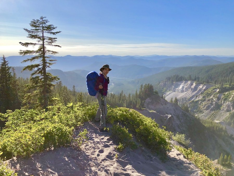
The Timberline Trail is widely considered to be one of the best hikes in the Northern Oregon area, and for good reason. There is a surprising amount of variety to the vegetation and geological features all around the mountain. You get amazing views of Mount Hood, as well as Mount St Helen's, Mount Rainier, Mount Adams, Mount Jefferson and the Three Sisters. You can also see the desert looking out from the east side. You get to hike through everything from lush forest to barren lava flows.

For such an impressive trail, the Timberline Trail is surprisingly accessible in terms of cost. If you start and and end at the Timberline Lodge trail head, there is no cost to park, or to do overnight stays on the trail. While it might be a bit challenging for someone of average fitness or injuries that could be aggravated with long, gradual uphill or downhill hikes, it isn't overly demanding in terms of physical fitness. Basically, if you're someone who does regular long hikes, and has backpacking experience, you can probably handle the trail.
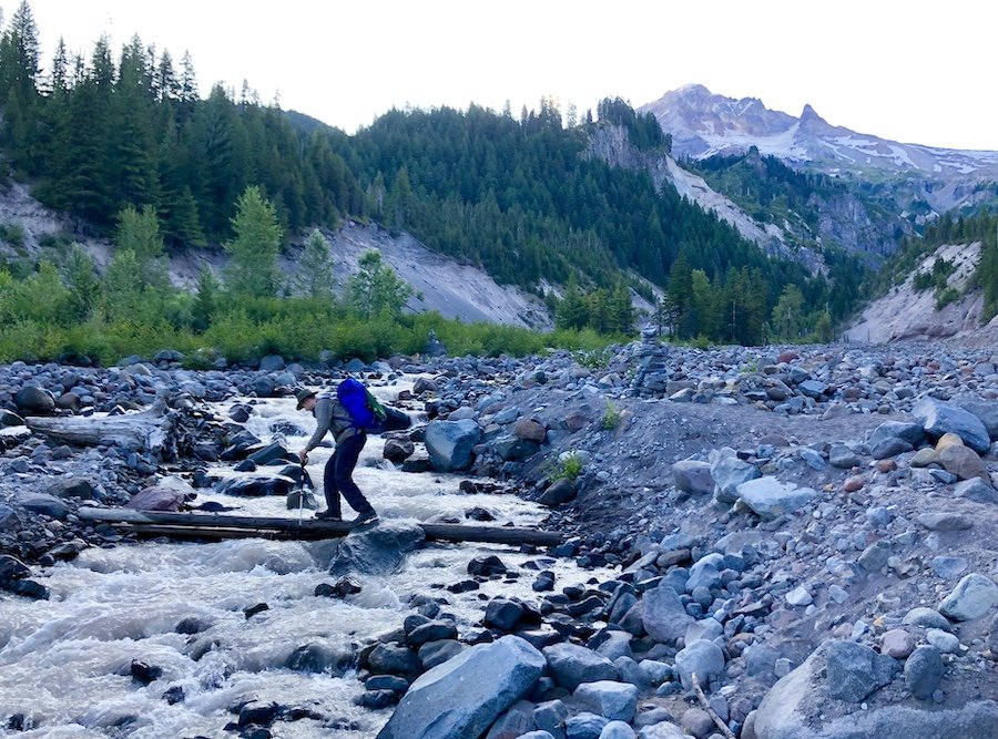
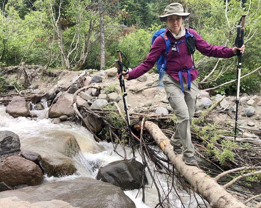
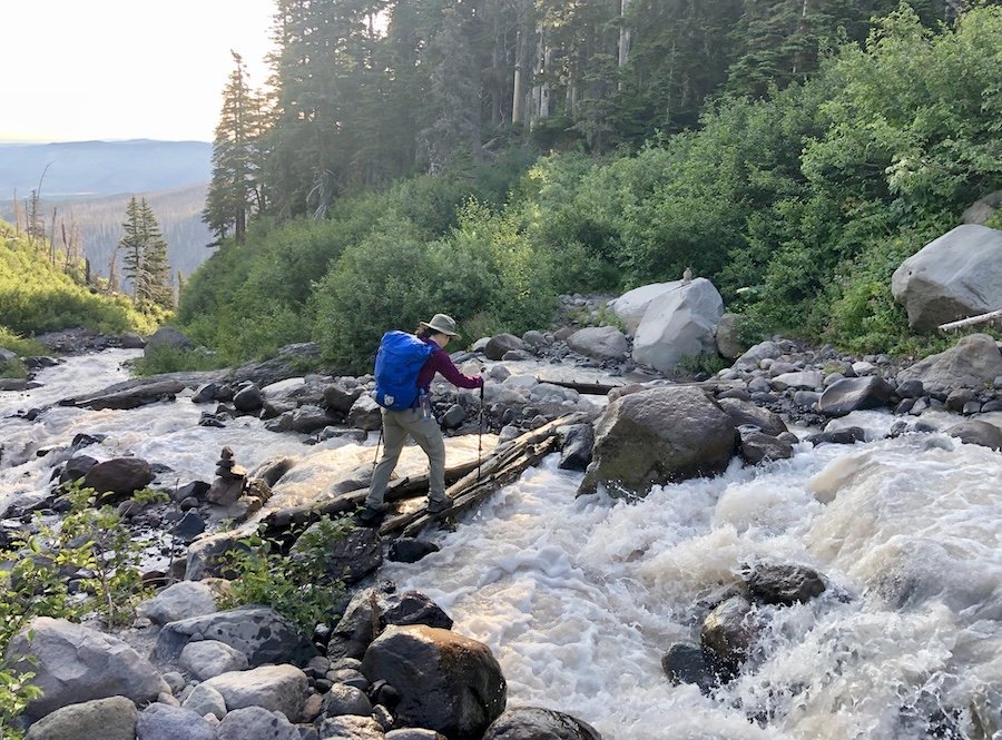
The trail is well marked and easy to follow, though it is a prudent to have GPS and a map, as there are some forks on the trail that can take you off the Timberline if you take the wrong one. There is intermittent cell phone reception all around the mountain, but there are long stretches when there is nothing, so keep that in mind. In terms of technical challenge, the hardest parts are the creek crossings. It's a good idea to have water shoes and trekking poles for crossings, and to try and handle trickier ones earlier in the day. The later in the day it is, the more glacier melt courses down the mountain, making for higher and faster flowing "creeks" that are more challenging to cross. I firmly believe that it's the creek crossings that truly give this trail its designation as being "difficult."
In the summer, water sources are plentiful all around the trail, but you do, of course, need some sort of water treatment. We used the Sawyer Squeeze as ours. If collecting water later in the day in a fast flowing creek, you might find there's a lot of sediment. We had to backwash our filter a few times along the trail to keep it flowing. Most of the camp areas do not have bear boxes/bear hangs, so make sure you bring a bear bag and enough line to hang it well off the ground to keep critters out of your food. There are also no outhouses along the trail, except for at Timberline Lodge and Cloud Cap campground, so be sure to bring a toilet kit (i.e. spade, sanitizer or soap, toilet paper, etc.) If you can, use the washroom at the lodge before you head on the trail then again at Cloud Cap to minimize the amount of cat holes you have to dig along the trail.
Day 1: Timberline Lodge to Sandy River (14.6km)
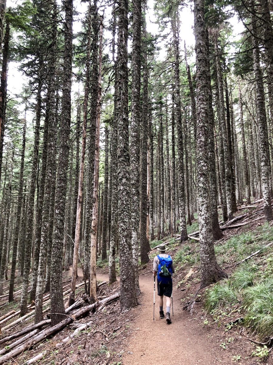
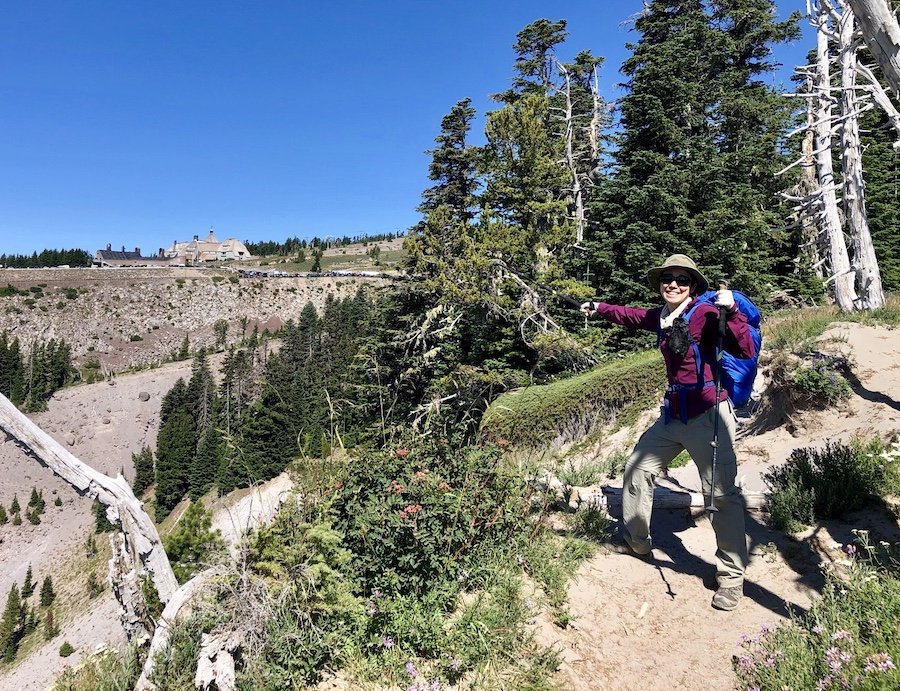
After a 6.5-hour drive, we arrived at the Timberline Lodge Trailhead. We filled up our water bottles then set off on the trail behind the lodge just after 3pm, heading the recommended clockwise route around the loop trail. The start of the trail was rocky with minimal vegetation. It was somewhat daunting in the hot, midday summer sun. Fortunately, it didn't take too long to reach the tree line for which the trail is named.


I had been warned by others who have hiked the trail that there are bouts of long treks downward and upward, many of which involve switch backs as you go up and down high and low sections of the trail. This proved accurate right from the start. In the early sections, we hiked a few kilometres all at a gradual uphill. We would reach a beautiful view point, looking down on a deep valley gorge, realizing that we would have to go all that way down in order to cross it. Dozens of downward switchbacks later, we would start the gradual uphill climb once again, then down we would go again to make the river crossing.
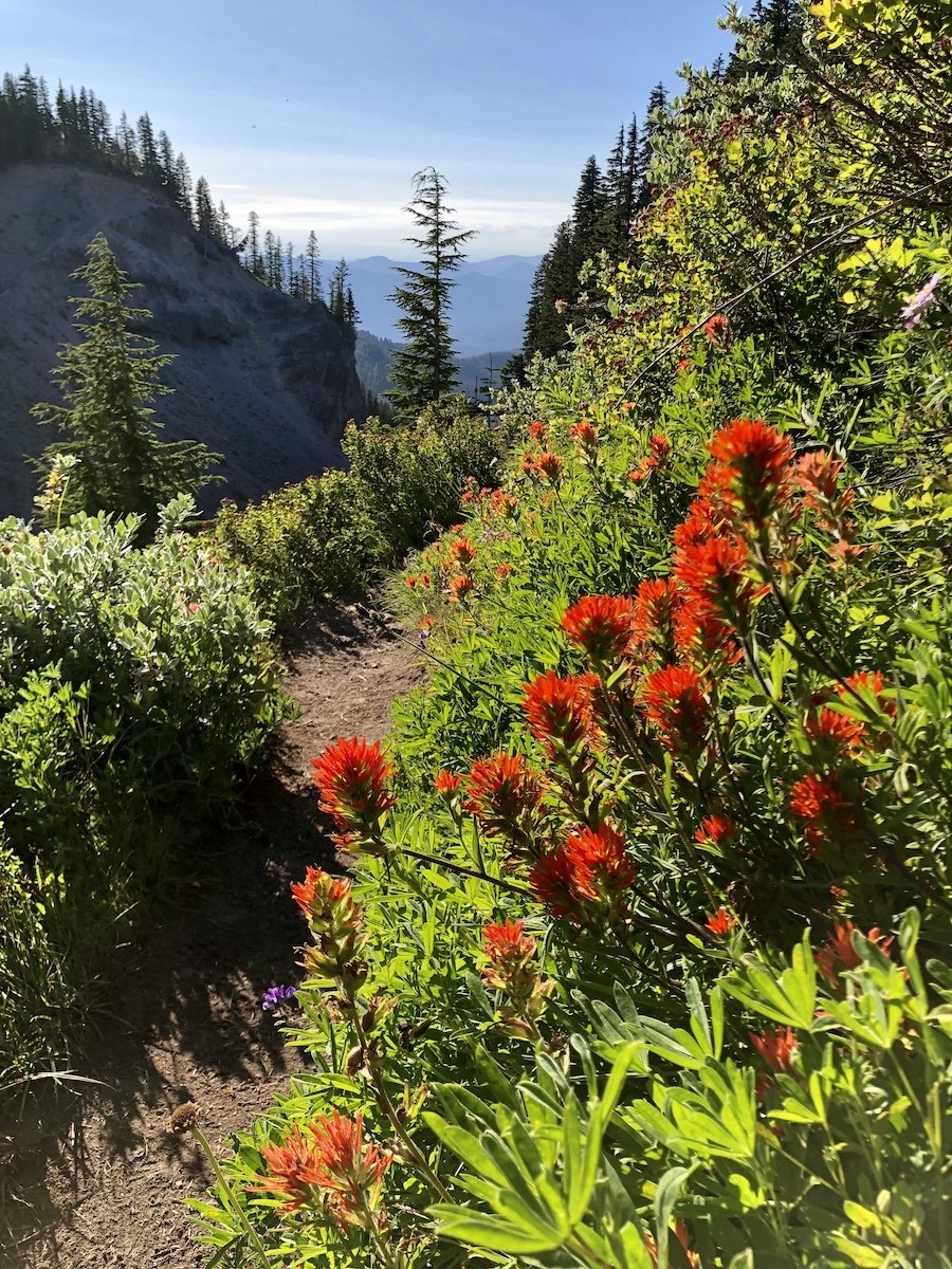
The first section of our hike had the most wild flowers, which were in full bloom for our early August hike. It was also the area where we saw the most people, mostly day-trippers who were hiking out and back from Timberline Lodge. Even at its busiest, it wasn't overwhelmingly busy. It was nowhere near as busy as Vancouver-area hikes like The Chief (in Squamish) or Quarry Rock (in Deep Cove) on a summer weekend. We did, however, start our hike on a Thursday, so that might have affected the numbers.
We passed a couple of different camp areas as we approached Sandy River, hoping to get to the camp area just on the other side before dark, but we only reached the river at 8pm and the water level was fairly high when we got there. Because it was so late, and we still needed to eat our dinner, we decided to cowboy camp, with just our mosquito net and bivy sacks for shelter, near the river and wait for morning to cross.
Day 2: Sandy River to Elk Cove Camp (17.4km)
We woke at dawn, our bivy bags covered in dew. Some of the water got through the mosquito net onto our down quilts, but nothing got totally soaked. We agreed that we would make sure we stopped early enough to set up the tarp for the second night though, especially since rain was predicted as a possibility for most of the second day and night. We took down our bear hang and set off.
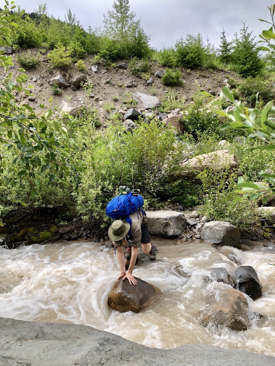
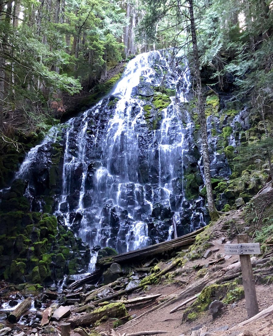
We crossed several more creeks, earlier in the day thankfully. Even before noon, some of the crossings required a bit of sleuthing to find the best route. Of course, we were also trying to do them without having to change our shoes, which we did manage. We stopped by Ramona Falls to fill up our bottles, while enjoying the view of the falls.
The early part of the hike on the second day was mostly through forest. As the weather became more overcast, with patches of rain, we were treated to misty views of the surrounding mountains and landscapes. It's hard to have your spirits dampened with the beauty the rain can bring to a mountain.
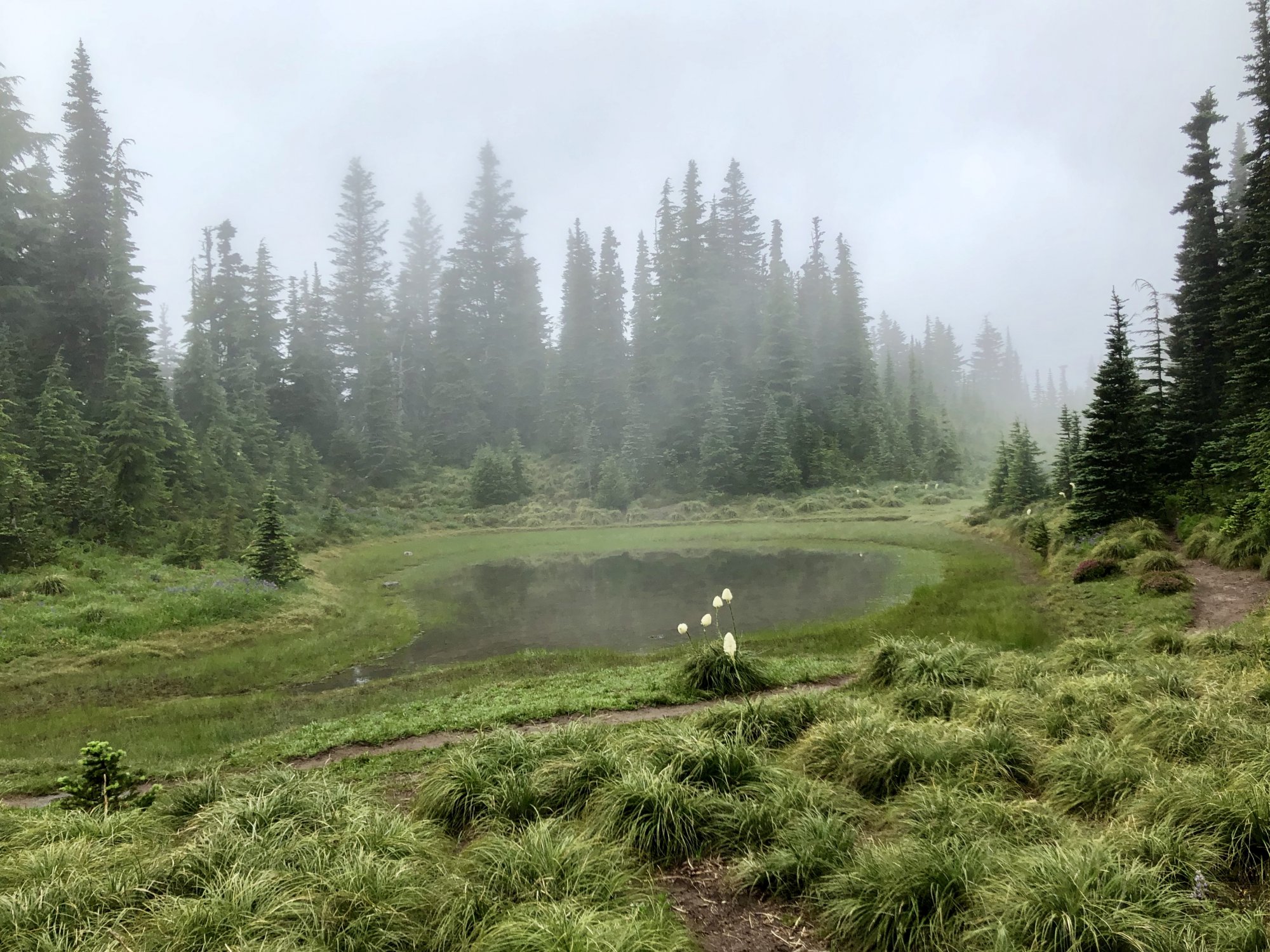
As the trail wound upward, we drifted above the timberline and were treated to some sweeping views while we held onto our hats. The exposed sections at higher elevations left us exposed to pelting winds. That section of the trail is quite narrow as well, so when we encountered other people, we had to inch past each other carefully one at a time. That terrain didn’t last too long before we ventured back below the timberline.
We came across a camp area with an old trapper cabin on the north-east side of the mountain. A few people had set up camp there for the night. We were tempted to stop, but decided to press on since there wasn't a convenient water source close by. We took a short break to take advantage of the cell reception that was available and pressed on.

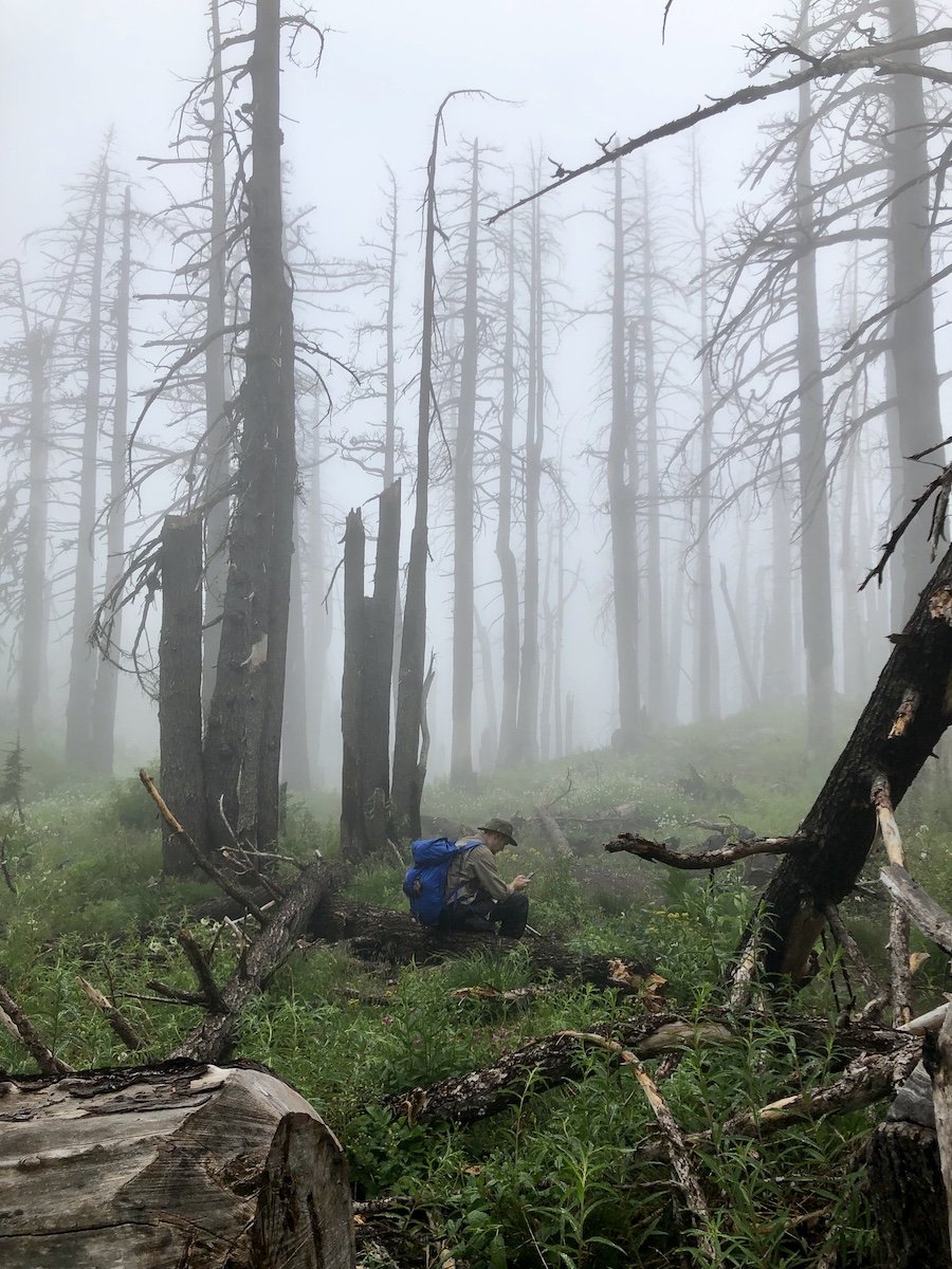
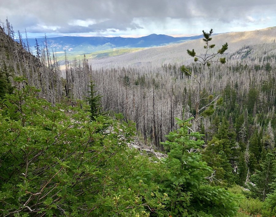
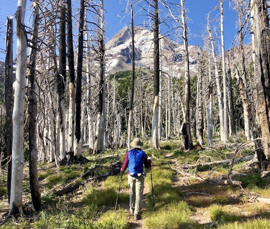
As we made the final approach toward Elk Cove Camp, we found ourselves in a section of woods on the trail that was ravaged by forest fire. It's kind of creepy as you hike your way through a forest of dead trees, like something out of a horror film. It was in this section though that I saw the only larger animal on the trail, a deer that I startled mid-feeding that bounded off down the mountainside.
There are several areas you can camp in at Elk Cove. The area near the stream already had lots of people set up to camp by the time we got there around 5pm. We decided to venture down to one of the less popular spots, which was for the best anyway, as it was a bit windy and exposed for tarp camping by the stream. We found a quiet spot amongst the trees with a nice view of Mount Hood and huddled up under our tarp before the rain came.

Day 3: Elk Cove Camp to Newton Creek (18.5km)
We headed back on the trail a bit earlier on the third day, starting at 7am, passing through the third camp area in Elk Cove, where hikers were still fast asleep in their tents. The sunrise treated us to some amazing views of Mount Hood and the surrounding area.


We knew we had a few of the bigger creeks to cross and wanted to get to them earlier before the glacier melts made them harder to cross. The weather cleared up and we were treated to some gorgeous views to the north as we continued to loop around Mount Hood. One challenging creek crossing had two spots to choose from for crossing. One was a wide, but very wet log further down the creek away from the trail. The other spot required us to make a huge leap over fast-moving water from a rock in the creek onto the dirt trail on the other side. It seemed like too much effort to go downstream to the log and slowly shimmy across it on our butts (walking across its wet surface would have been just too sketchy; one slip and you could easily bash your head on the rocks in the water below or on the log itself). Some fellow hikers, would-be good samaritans, tried to call us over to the log crossing to help us, thinking we just hadn't seen it. We didn't want to be rude, but we knew we could make the leap, even if it may have looked more daunting to them. Since Chris has longer legs, I let him go first then spot me for my jump, just in case. There were no photos of that particular creek crossing since we were so focused on getting across, but there were more than enough others for photo opportunities.

After going up and down a few more series' of switchbacks, we eventually made it to the Cloud Cap trailhead and campground, and its glorious outhouse. Seeing all the cars there that just drove their way up to the high point of elevation seemed so strange to me after all the efforts we had undergone to hike our way there. It was a nice place to stop and enjoy lunch on an actual picnic table and... ahem... take a load off at the outhouse.
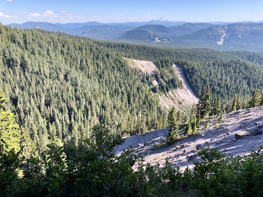
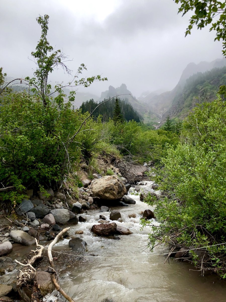
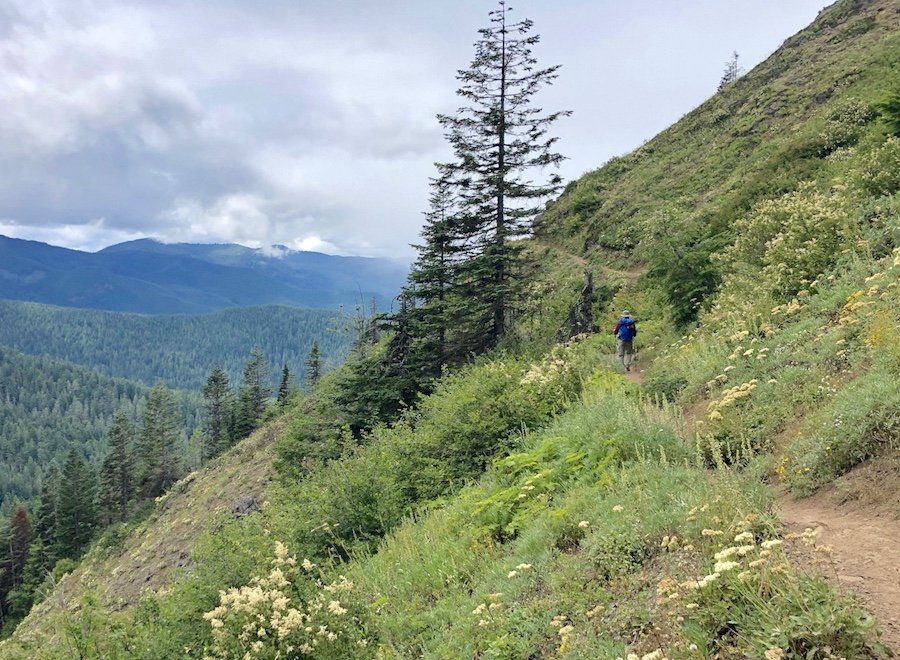
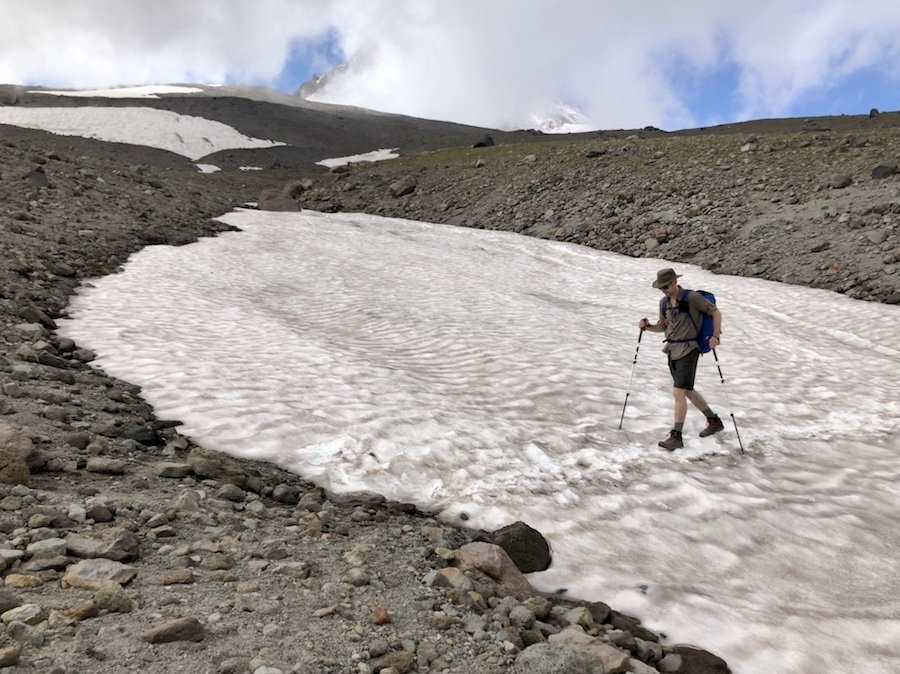
Continuing on south down the east side of Mount Hood brought a entirely different kind of hike. It was mostly exposed lava rock field, almost completely bereft vegetation, apart from the odd copse of straggly, wind-swept bushes. We were super thankful that it was mostly overcast during this time as it was mid-afternoon and it would have been so hot had we been hiking in the midday sun, even with the several glacier fields we had to cross. We also enjoyed the expansive views to the east, where we could see desert landscape in the distance.

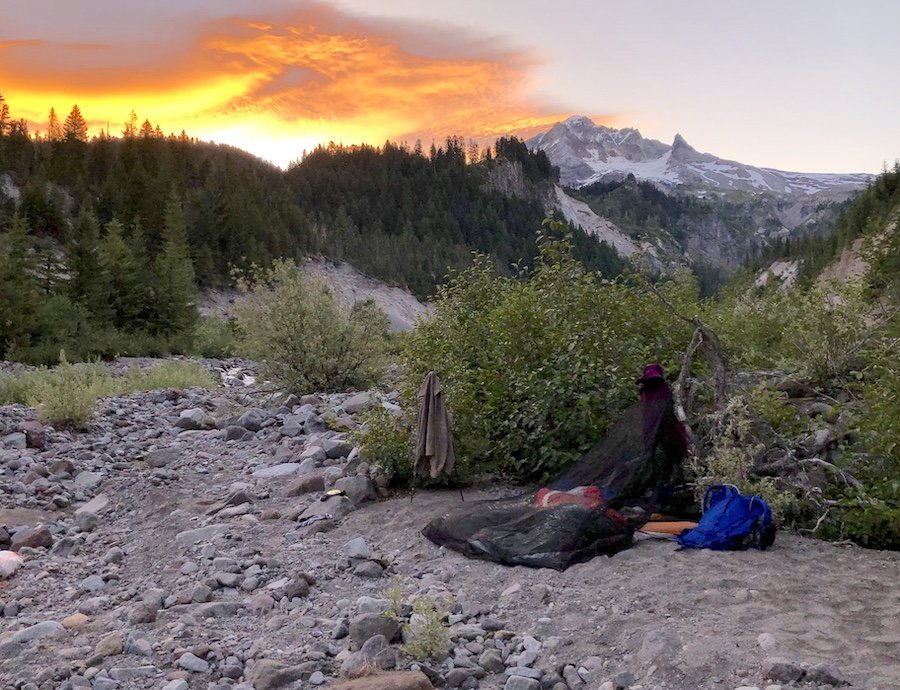
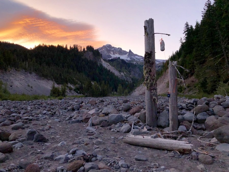
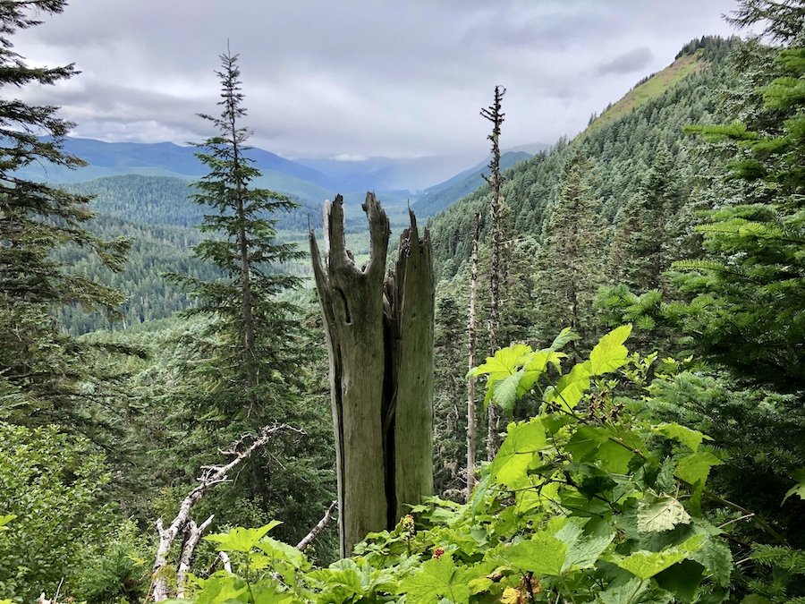
Eventually, we found ourselves switching back up, up and up to the top of a ridge, giving us an epic view of the rocky side of Mount Hood and the creek in the valley far below us, reminding us that we were going to have to make our way all the way down there ourselves. We hiked through the twisted trees and gradually wound our way down to Newton Creek where we set up camp for the night.


Day 4: Newton Creek to Timberline Lodge (14.5km)
We woke up early and broke camp to finish off the final leg of our journey around the Timberline Trail. The early morning light as it crept up the mountainside provided more spectacular views.

We were under the impression that the last leg would be a little easier, based on what we saw on the topographical maps. We were wrong. It did start off a bit easier, mostly moving laterally across the timberline, across grassy green hills. We even trekked across the top of a waterfall and even a ski hill that was closed for the season.


As we got to the final 5km, we were faced with steeper, longer switchbacks, both up and down, and the worst part were the sandy ascents from the bottom of a deep valley all the way back up to the Timberline Lodge. Sand has a way of sapping all your energy when hiking, as I discovered on the West Coast Trail. But dry sand causes you to slide down with every step, making it much worse for hiking than the wet sand beaches of the coast. As we hiked, I kept thinking, "We're close to the end, I know it. It must be just at the top of this rise..." And then we would get to the top of the rise, only to discover a steeper, sandier section of trail we had to heave ourselves up.

I definitely swore more than a few times. It didn't help that I really, REALLY needed to use the facilities, and in that part of the trail, there was no place to dig a cat hole in privacy. We just kept forging on, hoping it be over soon. As we climbed up toward one of the final ridges, we could see the lodge and our car, but as we got all the way up, we realized it was on the other side of an expansive valley, and that we would have to go further up the mountain in order to get across to it. So close, yet so far...

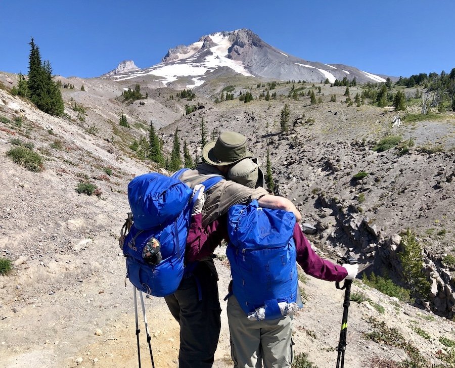
When we finally got off the trail, we were met by a lovely couple taking selfies in front of Mount Hood. They greeted us and offered to take a photo of us in our triumphant return to civilization. They got some awesome shots of us, and I offered to take some of them in return, despite my desperate need to find a toilet. As soon as I finished snapping them off, I waddled off as fast as I could to the flush toilets at the visitor centre where I found glorious relief.

Concluding Mount Hood's Timberline Trail
We completed the entire 65km of the Timberline Trail in 68 hours. We had to take all the different descents of this trail a bit more slowly than I'm used to, having to give Chris more rest periods for his knee. He has a knee condition that doesn't handle long periods of strain, and walking downhill is the worst kind of strain for it. It was also his first multi-day backpacking trip. But this was the hike we had chosen, and Chris was my partner for this hike, through thick and thin. If I had wanted to hike it by myself, I would have done so. It was far better for me to just go at the pace he needed so we could complete the whole trail together as a team. And I am so glad we did. We got to experience so many gorgeous sights all the way around the mountain. It was truly a joy to be able to share that with him, my partner.
Have you hiked the Timberline Trail around Mount Hood? If so, what was your experience like? Please share your thoughts in the comments. :)